Participatory planning procedures are a cornerstone of rural development initiatives, particularly those related to natural resource management. By centering voices and wisdom of the rural communities at the forefront of experiencing climate change risks, it is believed that sustainable natural resource management plans can be charted out, as this process will improve communities’ stakes and ownership in their landscape sustainability.
However, the on-ground process of mobilizing diverse stakeholders in the community, facilitating conversations, and resolution of conflicts, is complex and tedious. Landscape stewards, who are entrusted with the responsibility of conducting this process in villages in India, often get drained in data collection and administrative tasks, leaving them with little time to facilitate meaningful conversations with the community members.
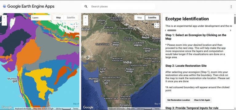
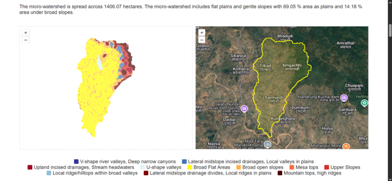
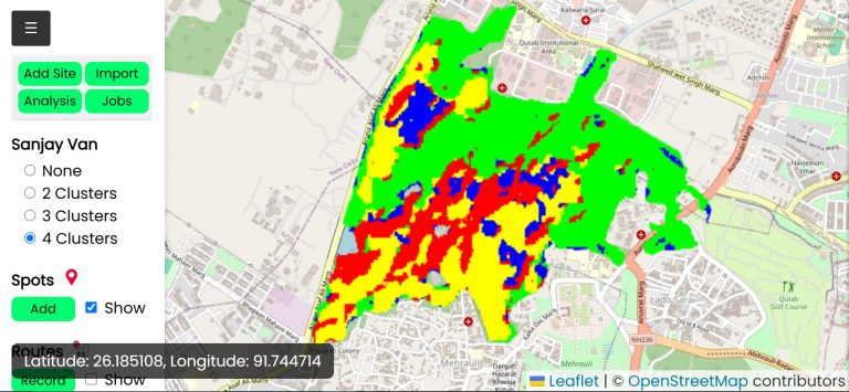
Commons Connect, a flagship tool under the CoRE Stack framework, enables landscape stewards to analyze social-ecological stresses in their micro-watersheds during PRA processes, using appropriate geospatial indicators that describe their landscapes. Hear one of our partner organizations, Utthan, working towards contextually relevant solutions for climate resilience and gender equity in Gujarat share their experience with using Commons Connect, of how it minimized the time spent in data collection and allowed stewards to focus more on community engagement.