More Participation, Less “AI”
Deeply reflective blog by Anuradha Ganapathy from her field visits to observe Commons Connect deployments with partners Foundation For Ecological…

Deeply reflective blog by Anuradha Ganapathy from her field visits to observe Commons Connect deployments with partners Foundation For Ecological…
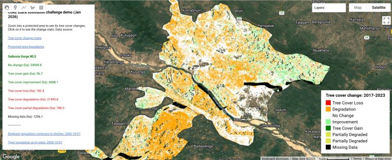
To accompany the CoRE stack innovation challenge, we have developed an app on Google Earth Engine which combines news articles on protected…
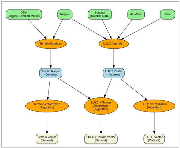
To accompany the CoRE stack innovation challenge, we have enhanced the starter-kit with an example of combining data from the…
Climate scientists recognized a while back about the importance of coming up with a standardized Earth System grid. Today most…

Can data-driven planning lead to a participatory and accountable approach to natural resource governance? Reflections from Ajmal, SUPPORT (Jharkhand) Hear…
Participatory planning procedures are a cornerstone of rural development initiatives, particularly those related to natural resource management. By centering voices…

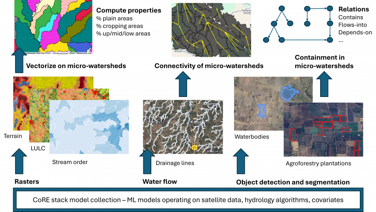
To accompany the innovation challenge (main doc with example problems), we have built a starter-kit that shows how you can…
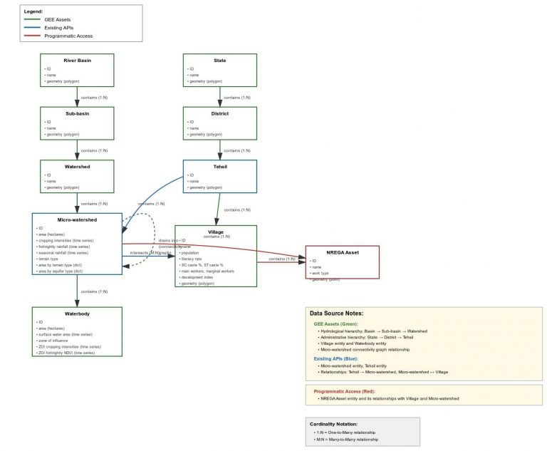
To accompany the innovation challenge (main doc with example problems), this ER diagram helpfully generated by Claude.ai (see chat) will…
Making Sense of Geospatial Data Workflows: Introducing STACD Working with geospatial data is like cooking a complex meal with many…
All CoRE stack code, datasets, technical methodology documents, research papers, etc. are published in the open [github repo, deep-wiki documentation]….