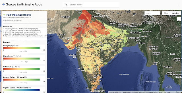
Natural Resource Management (NRM) works are taken up under the government welfare schemes like MGNREGA, PMKVY, etc. Many watershed structures like farm ponds, bunds, check dams, wells, etc. are built under these programs.
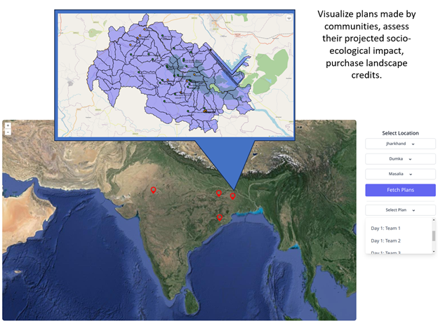
The main objective of this research is to quantitatively assess the changes caused by the farm ponds built under the government scheme Mahatma Gandhi National Rural Employment Guarantee Act (MGNREGA), which are observable through remote sensing techniques. Specifically, the research aims to:
- Identify sites from the MGNREGA data available on the MIS database, where planned NRM water-based interventions (farm ponds in our case) were undertaken.
- Monitor pre-post indicators for vegetation and cropping intensity.
- Develop a causal analysis framework to understand the change in outcome indicators.
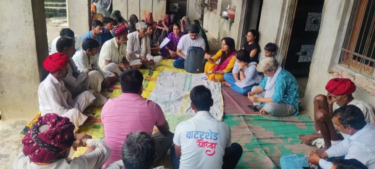
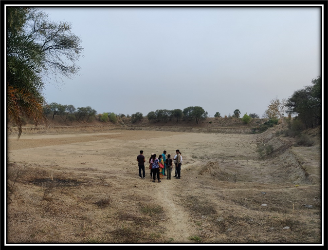
Using remote-sensing methods brings a lot of challenges in assessing the impact of the farm ponds and may lead to very incomplete insights. After going on a field visit in the Gaya district of Bihar, various discrepancies and complexities were found. For example, a sample farm pond was found as shown in Figure 1, which was constructed without any scientific analysis. This was found to be useless after construction because of its lack of ability to retain water in the pond. Later, it was discovered through remote sensing that there is a long 5 km lineament lying just below this pond, through which the water percolates underground and leaves the pond empty. Hence, the whole investment in the construction of the community pond was a wasted expenditure. Also, this would show no impact on the nearby farms when observed through remote sensing methods.
Some examples were found, where the data of the pond exists but the pond does not exist physically. Either it was never constructed (possibly a corruption case), or it was covered with mud again due to lack of use for the farmer.
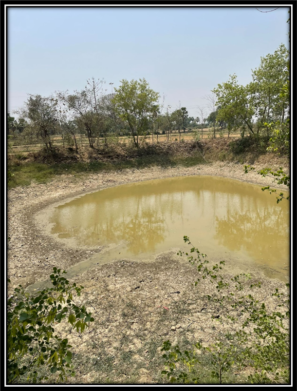
Even where the ponds existed, they did not necessarily lead to an increase in the cropping intensity for the farmer due to its low capacity, lack of rainfall, use of pond for pisciculture (as shown in Figure 2), or some other factors.
Hence, there are many complexities associated with assessing the impact of farm ponds when we observe from the sky using remote sensing methods, such as:
- Lack of water holding capacity: Due to the lack of scientific planning, the farm pond may have been constructed on a site with a lineament underneath (Figure 1). This could have led to a reduction in the water holding capacity of the farm pond, and hence no impact could be observed through remote sensing in the cropping intensity of the farms around it.
- Conversion to cropping land: Some farmers who don’t find the farm pond useful, may fill it up again with soil for cropping. This can lead to inconsistencies in the data pertaining to the existence of the farm ponds.
- Delineation of farms: It is impossible to predict at what distance or in which farms around the pond, the water will be shared for irrigation through pumps.
- Non-uniformity in usage: The farm pond may be used for other purposes like pisciculture instead of or in addition to irrigation (Figure 2). The impact of farm ponds having other uses is difficult to assess.
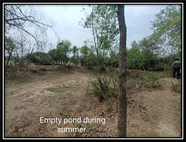
- Seasonal Impact: Farm ponds may hold water till the Zaid season or sometimes dry up in the Rabi season itself (as shown in Figure 4). It is difficult to estimate the season in which the farm pond will be used for irrigation of crops.
- Crop Yield Impact: Some farm ponds may help increase the crop yield through protective irrigation in a drought year or by increasing the cropping intensity on the farm (moving from a single crop in a year to 2-3 crops in a year). However, accurate crop yield data is not available at the farm level.
- Period of impact: Some farmers may immediately start using the farm ponds and grow crops in Rabi/Zaid season. Some farmers wait a year or more before relying on the farm pond for irrigation. Hence, there is a variation in which year(s) the actual impact of the farm pond can be observed.
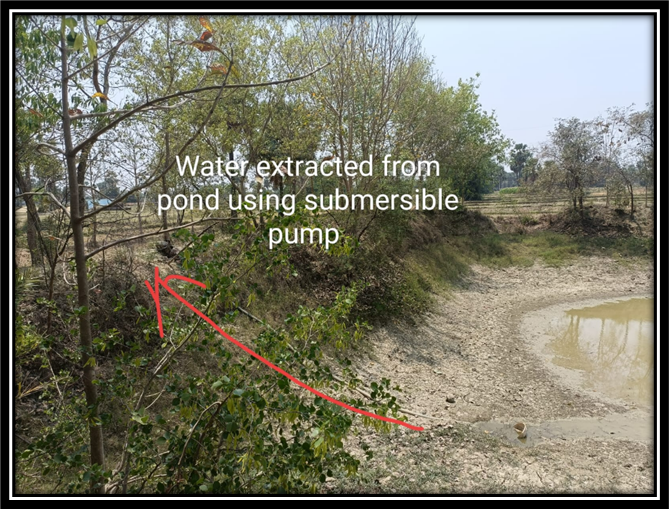
- Pumping of groundwater into farm ponds: Some farm ponds are filled with groundwater using pumps for fisheries when they dry up. This is a misleading factor in that the farm ponds hold water from rainfall or natural drainage systems.
- Data issues (inaccuracy in geotagging the farm ponds): The geotagged position (latitude/longitude) of the pond may lie on one corner or at a distance from the pond, making it difficult to assess the extent of the farm pond inside the farm.
· Data issues (work type): Some bigger water bodies like Ahars or maintenance works are wrongly mentioned as farm ponds in the work type while digitizing the information in the database.
· Size of farm pond: It is difficult to distinguish bigger farm ponds from smaller ones, and their impact would vary with size.