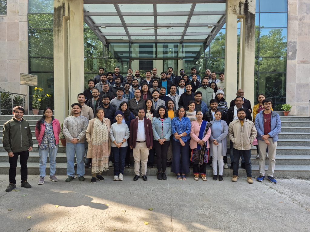
The second CoRE stack landscape solvability workshop held at IIT Delhi from Dec 15-17 brought together 80+ people from over 30 organizations, to discuss and debate and give shape to new directions in the CoRE stack. The gathering included development practitioners, ecologists and restoration experts, environment research organizations, computer scientists, and design and programme teams from various partners in the CoRE stack network. We had a long agenda over 2.5 days, with 10 speakers and 5 breakout sessions across 5 groups, and worked on many aspects:
- Multi-actor platforms and how data and tech can help
- Decision support and impact assessment for waterbody rejuvenation initiatives
- Decision support for agrohorticulture and restoration initiatives
- Community-based water budgeting methods
- Experiences from the use of Commons Connect in the field
- Role of landscape stewards and building a reliable financial stream for them
- New opportunities with using satellite data, drones, and bioacoustic sensors for ecological monitoring
The workshop was a shared exercise in learning, thinking, questioning, and building together, to make landscape-scale climate action work on the ground. A recurring theme across conversations was that a challenge facing rural climate and water security efforts in India is the difficulty of coordination, between departments, disciplines, organizations, and most importantly, between data and lived experience. The workshop opened by grounding this problem through the lens of the Multi-Actor Platforms (MAPs), which framed landscapes as shaped by ecological aspects, livelihoods, and governance. This framing became the backbone of the discussions that followed. Watch Ravindra’s talk on the MAP process in Boipariguda in Koraput, Odisha.
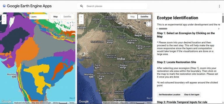
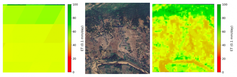
The CoRE Stack will never be a finished product and the workshop treated it as a work-in-progress, shaped through collective brainstorming. Everyone engaged deeply with the Know Your Landscape dashboards, not as passive users, but as co-designers. Partners working in very different contexts from forested areas in Odisha to water-stressed blocks in Gujarat saw if their local knowledge could be represented with geospatial indicators, and surfaced both possibilities and gaps: new aspects the data revealed, what it obscured, and where community knowledge must fill in the blanks. Watch Utthan’s talk on criteria they follow to identify agroforestry sites, emphasizing most importantly on social dimensions of supporting communities in a changing climate where cropping is becoming increasingly difficult.
We similarly debated how waterbody rejuvenation decisions should balance remote-sensed indicators with on-ground observations like damaged sluice gates or patterns of community use. Agrohorticulture discussions similarly revealed tensions between technical feasibility and livelihood relevance, pushing us to jointly redefine how “suitability” itself should be understood.
Reflections on Commons Connect which is being actively used on the ground brought stories on how combining maps, local data, and facilitated discussions helped communities articulate demands more clearly and engage more confidently with Gram Sabhas and government officials. The key aspect was to not look at technology as an endpoint, but as a medium to enable dialogue, transparency, and trust, especially on equity issues in communities. Watch FES’s talk on how they are combining Commons Connect and CLART with effective community consultations.
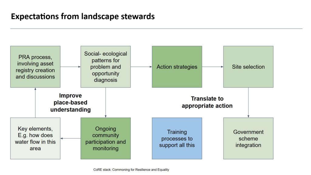
By the final day, conversations shifted toward the future: how to sustain landscape stewardship beyond short project cycles, how to support stewards as long-term actors, and how public systems and digital infrastructure can evolve together. Our expectations from landscape stewards are very high and many unknowns on training, financial sustainability, building consensus, and imbibing shared social-ecological principles need to be uncovered to solve this.
We now have a long roadmap ahead of us to continue to enhance the CoRE stack and make it more and more relevant for community-based social-ecological action. Stay tuned!