Stories from the ground from Commons Connect usage
Can data-driven planning lead to a participatory and accountable approach to natural resource governance? Reflections from Ajmal, SUPPORT (Jharkhand) Hear…

Can data-driven planning lead to a participatory and accountable approach to natural resource governance? Reflections from Ajmal, SUPPORT (Jharkhand) Hear…
Connected to our work on continuous ecological monitoring, we set up bioacoustics recorders at four sites in Delhi to continuously…
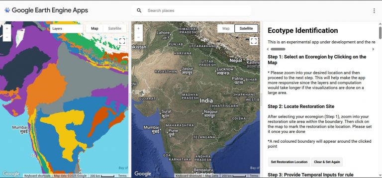
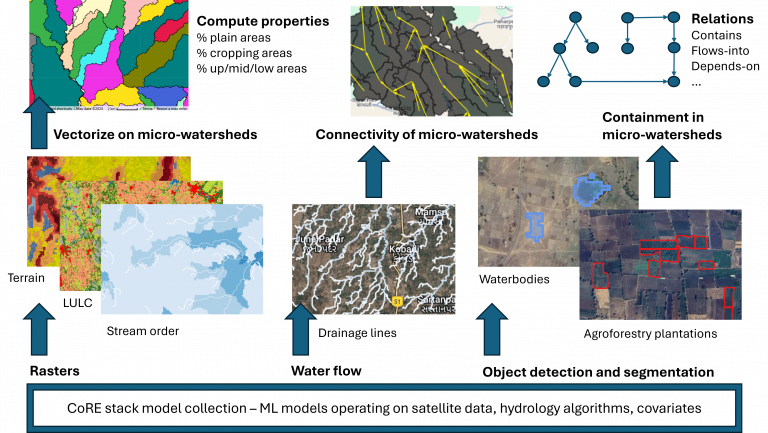
Restoration sites are typically identified using expert-defined rules on land use, elevation, rainfall, etc., or through change detection from historical…
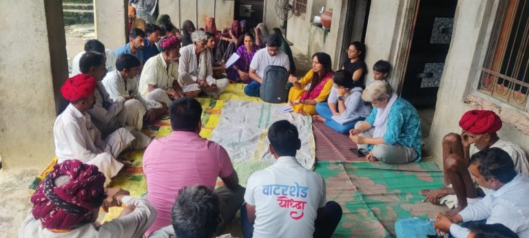
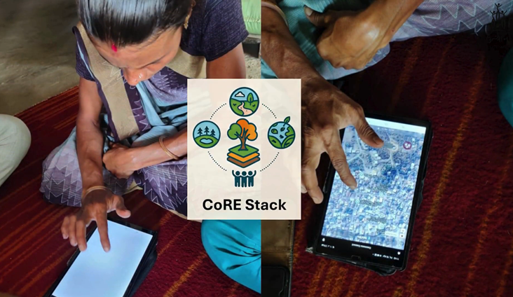
Published: July 2025 How can digital tools strengthen local planning and ensure that the voices of rural communities shape their…
The Mahatma Gandhi National Rural Employment Guarantee Act (MGNREGA), enacted in 2005, was designed as a powerful tool to ensure…

In a world where climate change and environmental degradation are becoming increasingly urgent, digital technologies are stepping up to provide…
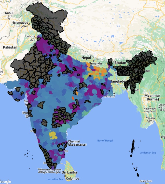
We’re excited to introduce the updated Know Your Landscape (KYL) dashboard! This powerful tool helps you dive deep into the…
Forests and plantations are the backbone of our planet’s ecological balance, offering habitats, absorbing carbon dioxide, regulating climate, and sustaining…
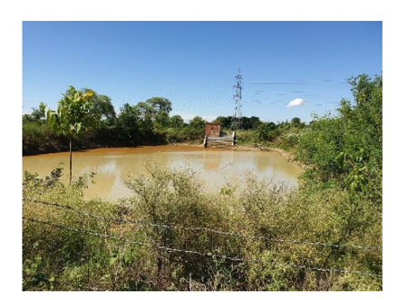
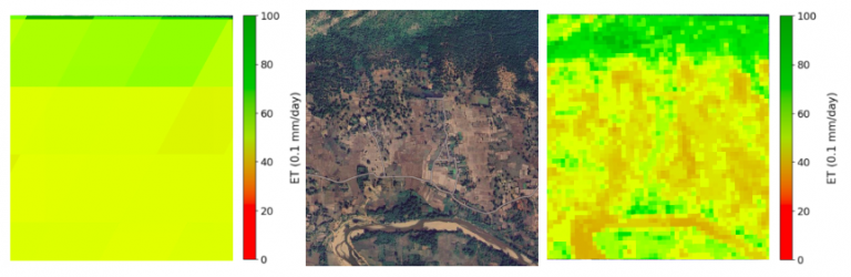
Assessing the impact of farm ponds on agricultural productivity in Northern India Introduction Government welfare schemes such as the Mahatma…
Objective Over the years, the amount of cropping and by extension the water used for cropping has intensified greatly. The…
ACM COMPASS is an international conference focused on the application of computing technologies for sustainability. COMPASS 2024 was held in…
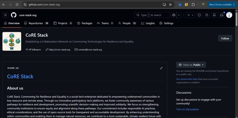
We launched the CoRE stack innovation challenge on Nov 22, 2025, least expecting the tremendous participation we saw from students,…
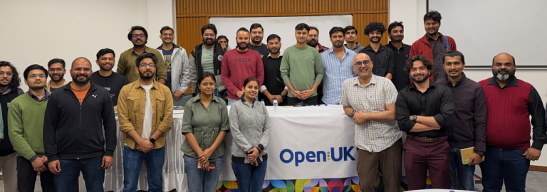
The prolific Anil Madhavapeddy from the University of Cambridge, behind many key outputs including OCaml, Docker, Xen, among others, ran…
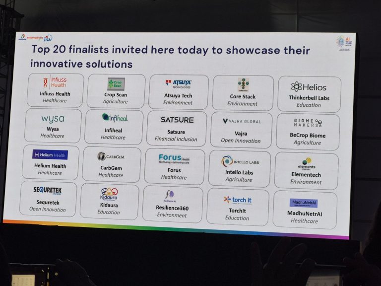
We are delighted that the CoRE stack was selected among the top-20 finalists in the AI for ALL challenge organized…

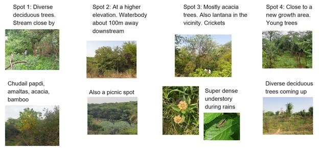
Deeply reflective blog by Anuradha Ganapathy from her field visits to observe Commons Connect deployments with partners Foundation For Ecological…
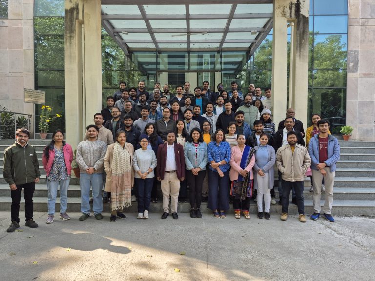
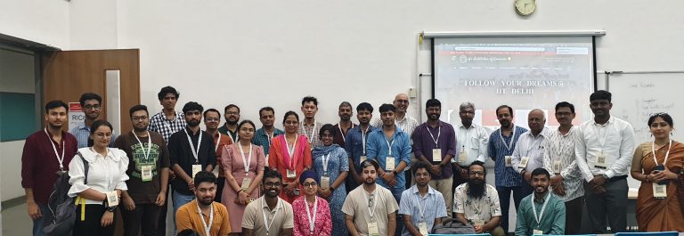
The second CoRE stack landscape solvability workshop held at IIT Delhi from Dec 15-17 brought together 80+ people from over…
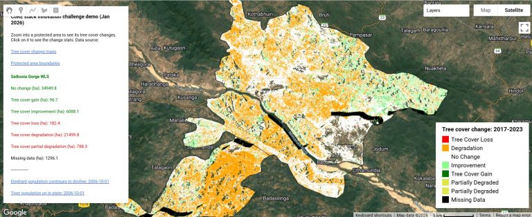
To accompany the CoRE stack innovation challenge, we have developed an app on Google Earth Engine which combines news articles on protected…
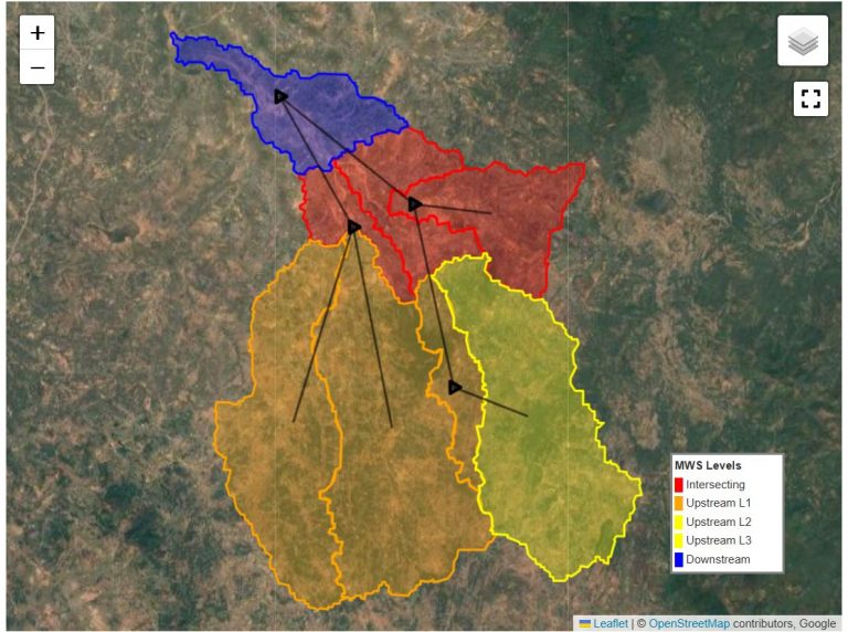
To accompany the CoRE stack innovation challenge, we have enhanced the starter-kit with an example of combining data from the…
Climate scientists recognized a while back about the importance of coming up with a standardized Earth System grid. Today most…
Participatory planning procedures are a cornerstone of rural development initiatives, particularly those related to natural resource management. By centering voices…