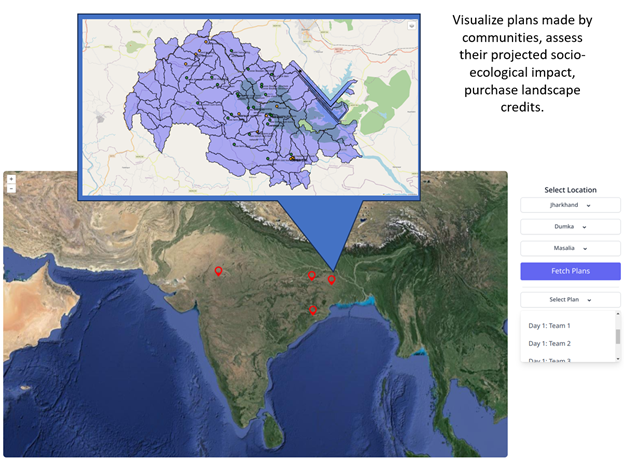
Ground truth is a “gold standard” that can be used to build, compare, and evaluate classification models. In supervised learning algorithms, ground truth data is critical to training new algorithms. The more annotated data is available, and the higher its quality, the better algorithms will perform. Even if training is unsupervised (due to lesser available data), some ground truth is still required to evaluate the model’s performance. For this purpose, we have initiated a LULC Groundtruth data collection activity via QField App.
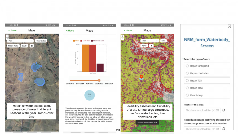
We have designed an application on the QField App using which our field partners can mark individual farm plots and enter specific metadata associated with the cropping practice on each plot. The farm plots can be delineated by physically walking on the field and marking the polygon via the GPS facility in the app.
The metadata form associated with each farm marking involves the farmer details (like name, contact number, etc.), crop/plantation details (like crop type, sowing and harvest time, irrigation method, etc.) and whether the land was fallow in any duration or not. The field volunteers are requested to add this information for as many years as they can recall.
Once this data is entered into the Qfield application, it is processed by the moderators for different validation checks like correctness of marked farm polygon, the validity of sowing and harvest time, visualizing time series data from remote sensing to validate the cropping pattern (single/double/triple cropping). The accepted data is then pushed to the servers and used for LULC classification.