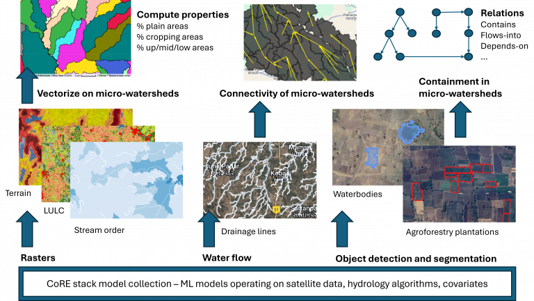
A micro-watershed registry for India
Climate scientists recognized a while back about the importance of coming up with a standardized Earth System grid. Today most…
Climate scientists recognized a while back about the importance of coming up with a standardized Earth System grid. Today most…

Can data-driven planning lead to a participatory and accountable approach to natural resource governance? Reflections from Ajmal, SUPPORT (Jharkhand) Hear…
Participatory planning procedures are a cornerstone of rural development initiatives, particularly those related to natural resource management. By centering voices…

To accompany the innovation challenge (main doc with example problems), we have built a starter-kit that shows how you can…
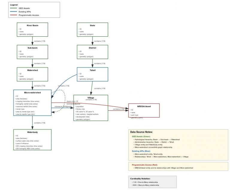
To accompany the innovation challenge (main doc with example problems), this ER diagram helpfully generated by Claude.ai (see chat) will…
Feb 23, 2026: Three contributions have advanced to the next stage of follow-on support to enhance the PoCs into a…
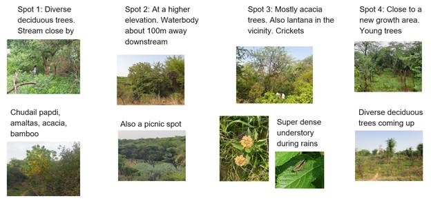
Connected to our work on continuous ecological monitoring, we set up bioacoustics recorders at four sites in Delhi to continuously…
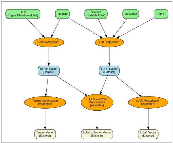
Making Sense of Geospatial Data Workflows: Introducing STACD Working with geospatial data is like cooking a complex meal with many…
Update, Nov 19, 2025: As a follow-up from the workshop, we have put together this living database of useful tools…
Field data collection sounds simple in theory: go out, observe things, record what you find. In practice, it quickly turns…